Overview
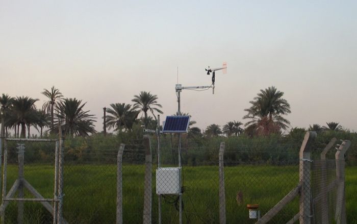
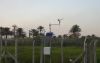
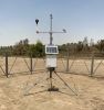
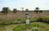
Iraq’s Ministry of Agriculture has deployed a nationwide network of solar-powered, satellite-linked agrometeorological stations. The stations provide open data to farmers, government planners, and researchers, supporting evidence-based agricultural policies, crop management, and seasonal planning.
By making localized weather and climate information available online, the network enables better decisions for irrigation, crop protection, and research, ultimately contributing to more resilient agriculture across Iraq.
The project was implemented in collaboration with the local Campbell Scientific partner, Al-Fakhar for Engineering Projects Co. Ltd.; the technical teams of Iraq's Ministry of Agriculture who managed installation and commissioning; and the end user, the Iraqi Agrometeorological Center, who operates the network and shares the data with farmers and researchers.
The Challenge
Agriculture in Iraq faces several constraints:
- Unreliable power and connectivity in rural areas make continuous data collection difficult.
- Farmers often lack timely, localized weather information to align irrigation and crop protection with actual field conditions.
- Policy makers and researchers need accurate, comparative data to track seasonal variations, validate research trials, and guide agricultural extension programs.
Without reliable measurements, decisions are often based on guesswork, reducing efficiency and increasing vulnerability to climate variability.
The Solution
Campbell Scientific supplied agrometeorological monitoring stations equipped with sensors for:
- Air temperature and humidity, including evapotranspiration (ET) and thermal assembly
- Wind speed and direction
- Solar radiation
- Rainfall
- Soil temperature
- Barometric pressure
Each station is solar powered and fitted with satellite telemetry (TX unit, GNSS antenna, charge regulator, and battery), ensuring continuous operation—even in remote or grid-unstable locations.
The network continuously measures weather and soil conditions, translates the data into crop advisories, and delivers the advisories to farmers via www.agromet.gov.iq.
Open Data, Practical Impact
Open data can be used to create practical impact in agriculture by aligning irrigation schedules with actual rainfall and ET patterns, selecting spray windows when wind speeds are low and humidity is favorable, and monitoring heat or cold events during sensitive crop stages. The data can also help validate field trials and extension advisories with local evidence, ensuring recommendations are both accurate and actionable.
Where the Network Is Already Making a Difference
Here are some examples of where this agrometeorology network is already making a difference:
- The Al-Mishkhab Rice Research Station supports water-efficient rice cultivation and seed multiplication.
- The Al-Madaen Nursery and Forest, which is a protected area, enables microclimate monitoring for forestry and anti-desertification.
- The Al-Shatrah Demonstration Farm provides real-time observations for agricultural extension and training programs.
Next Steps
Plans for the network include expanding its reach by exporting climate bulletins in collaboration with agricultural research institutions, which would further enhance the application of agrometeorological data for farming communities across Iraq.